Weekend Storms Threaten Flooding Across Multiple Australian States
By Chloe · Published 24 Oct 2026 · Updated 24 Oct 2026
Brisbane, QLD · Queensland News
Safety note: Admin approval is an initial review, not a guarantee that every detail is correct. Check important or urgent claims with official sources and report anything inaccurate or unsafe.
Source and credit: Contributor's own report
Weekend Storms Threaten Flooding Across Multiple Australian States - Brisbane, QLD
Smart summary
Heavy rain and severe thunderstorms are forecast across eastern and southern Australia, with flood risks remaining high in parts of Queensland.
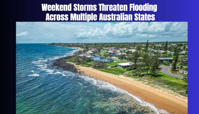
Australia is preparing for another unsettled weekend as widespread rain and thunderstorms are forecast across several states, increasing concerns about flash flooding, dangerous driving conditions and disruption to local communities. The latest weather outlook, published on 24 October 2026, indicates that Queensland remains particularly vulnerable after days of intense rainfall across the south-east.
Queensland has experienced a prolonged period of wet weather, with some areas recording exceptionally high rainfall totals. The Sunshine Coast hinterland and parts of the Moreton Bay region have received approximately 300–400 millimetres over seven days, while some locations have recorded totals approaching 450 millimetres. The heavy rainfall has saturated the ground, raised waterways and created conditions in which further downpours could trigger rapid flooding.
The Bureau of Meteorology has issued multiple flood warnings across southern Queensland. Additional showers and potentially severe thunderstorms are expected in central and south-east Queensland, including areas around Brisbane, Bundaberg, Rockhampton, Gladstone and the Sunshine Coast hinterland. Heavy rainfall remains a major concern because already saturated catchments may struggle to absorb additional water.
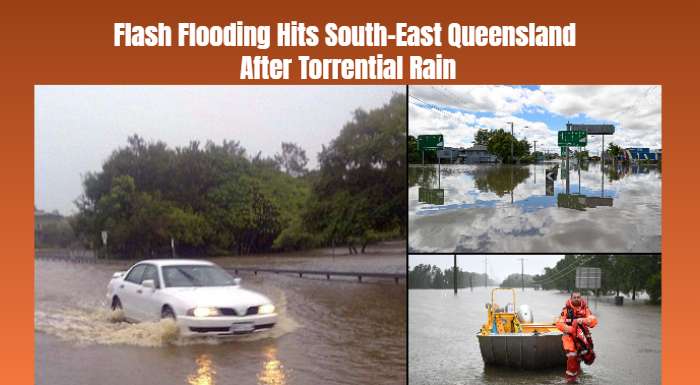
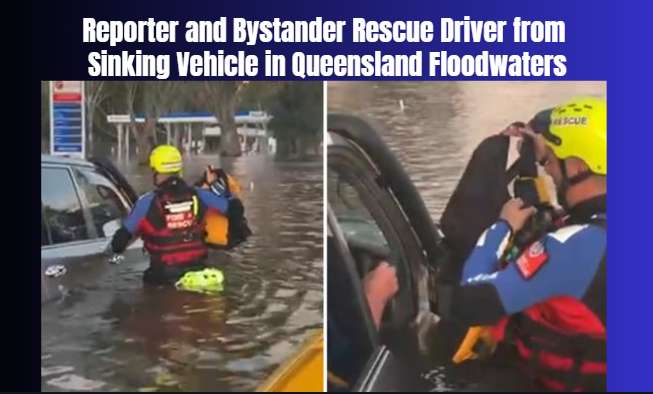
The recent weather has also placed pressure on emergency services. Earlier flooding across south-east Queensland led to numerous requests for assistance, water rescues and school closures. Floodwater has affected roads and residential areas, highlighting the danger of travelling through flooded streets and crossing submerged roads. Authorities continue to urge residents to follow official warnings and avoid entering floodwater.
The unsettled conditions are not expected to remain limited to Queensland. A cold front moving across southern Australia is forecast to bring rain and thunderstorms through South Australia, Victoria and Tasmania. Some areas could experience heavy downpours, strong winds and isolated hail. The weather system is expected to interact with warm, moisture-rich air over the eastern states, creating conditions favourable for further storm development.
New South Wales is also likely to experience showers and thunderstorms, particularly across the north-east. Conditions could become more active on Sunday, with storms forecast in parts of western New South Wales and north-eastern Victoria. Sydney and Brisbane may also experience further unsettled weather as the systems move across the region.
The potential impacts include localised flash flooding, traffic delays, fallen branches, power interruptions and temporary disruptions to outdoor activities. Residents in flood-prone areas are advised to monitor weather alerts, keep away from swollen creeks and rivers, and follow directions from emergency authorities. Drivers should never attempt to cross a flooded road, even when the water appears shallow.
Although the persistent rain has caused significant disruption, rainfall can also provide relief to areas that have experienced dry conditions. However, the immediate priority remains community safety as additional storms develop.
Weather conditions may change rapidly throughout the weekend. Residents should check the latest Bureau of Meteorology forecasts and local emergency warnings before travelling or making outdoor plans.
AcrossConditionsWeatherAreasQueensland
Australia is preparing for another unsettled weekend as widespread rain and thunderstorms are forecast across several states, increasing concerns about flash flooding, dangerous driving conditions and disruption to local communities. The latest weather outlook, published on 24 October 2026, indicates that Queensland remains particularly vulnerable after days of intense rainfall across the south-east.
Queensland has experienced a prolonged period of wet weather, with some areas recording exceptionally high rainfall totals. The Sunshine Coast hinterland and parts of the Moreton Bay region have received approximately 300–400 millimetres over seven days, while some locations have recorded totals approaching 450 millimetres. The heavy rainfall has saturated the ground, raised waterways and created conditions in which further downpours could trigger rapid flooding.
The Bureau of Meteorology has issued multiple flood warnings across southern Queensland. Additional showers and potentially severe thunderstorms are expected in central and south-east Queensland, including areas around Brisbane, Bundaberg, Rockhampton, Gladstone and the Sunshine Coast hinterland. Heavy rainfall remains a major concern because already saturated catchments may struggle to absorb additional water.
The recent weather has also placed pressure on emergency services. Earlier flooding across south-east Queensland led to numerous requests for assistance, water rescues and school closures. Floodwater has affected roads and residential areas, highlighting the danger of travelling through flooded streets and crossing submerged roads. Authorities continue to urge residents to follow official warnings and avoid entering floodwater.
The unsettled conditions are not expected to remain limited to Queensland. A cold front moving across southern Australia is forecast to bring rain and thunderstorms through South Australia, Victoria and Tasmania. Some areas could experience heavy downpours, strong winds and isolated hail. The weather system is expected to interact with warm, moisture-rich air over the eastern states, creating conditions favourable for further storm development.
New South Wales is also likely to experience showers and thunderstorms, particularly across the north-east. Conditions could become more active on Sunday, with storms forecast in parts of western New South Wales and north-eastern Victoria. Sydney and Brisbane may also experience further unsettled weather as the systems move across the region.
The potential impacts include localised flash flooding, traffic delays, fallen branches, power interruptions and temporary disruptions to outdoor activities. Residents in flood-prone areas are advised to monitor weather alerts, keep away from swollen creeks and rivers, and follow directions from emergency authorities. Drivers should never attempt to cross a flooded road, even when the water appears shallow.
Although the persistent rain has caused significant disruption, rainfall can also provide relief to areas that have experienced dry conditions. However, the immediate priority remains community safety as additional storms develop.
Weather conditions may change rapidly throughout the weekend. Residents should check the latest Bureau of Meteorology forecasts and local emergency warnings before travelling or making outdoor plans.
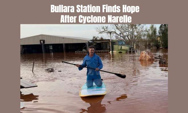
A remote Western Australian station is looking for positives after Cyclone Narelle brought damaging weather, highlighting the resilience of regional com...
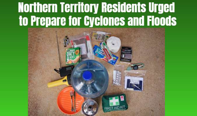
Northern Territory authorities are urging residents to prepare early for another potentially severe wet season, with cyclones, flooding and dangerous st...
Queensland authorities are pursuing tougher legal penalties against the owner of two dogs that seriously injured a man in Brisbane’s north, while the po...
An ABC reporter and a bystander rescued a driver trapped inside a vehicle that was rapidly sinking in floodwater, highlighting the dangers of driving th...
An unconventional mosaic featuring sequins, high heels and discarded beauty items is bringing a celebrated Australian drag performer’s image into the wo...
Researchers have confirmed that an endangered colony survived devastating cave flooding, but low population numbers and limited genetic diversity are ra...
Queensland authorities are pursuing tougher legal penalties against the owner of two dogs that seriously injured a man in Brisbane’s north, while the po...
An ABC reporter and a bystander rescued a driver trapped inside a vehicle that was rapidly sinking in floodwater, highlighting the dangers of driving th...
Planned train timetable changes affecting Sydney and the Illawarra have been abandoned following strong opposition from commuters, less than a month bef...