Safety note: Admin approval is an initial review, not a guarantee that every detail is correct. Check important or urgent claims with official sources and report anything inaccurate or unsafe.
Source and credit: Contributor's own report
Hazard Reduction Burn Planned Near Armidale and Uralla This Weekend - Armidale, NSW
Smart summary
An 800-hectare hazard reduction burn in Oxley Wild Rivers National Park is planned near Armidale and Uralla, with authorities warning smoke may affect nearby communities including Spring Camp, Enmore and Blue Knobby.
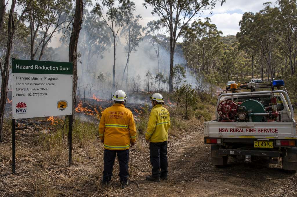
An extensive hazard reduction burn is planned in Oxley Wild Rivers National Park near Armidale and Uralla this weekend, with authorities warning that smoke from the operation may be visible across parts of the surrounding New England region.
The planned burn covers approximately 800 hectares and is being undertaken as part of ongoing bushfire management activities. Hazard reduction burns are designed to reduce the amount of vegetation and other fuel available to future bushfires, helping lower potential fire intensity and protect communities and surrounding environments.
Authorities have warned that smoke generated by the burn could drift across nearby areas, including Spring Camp, Enmore and Blue Knobby. Residents in and around these locations may notice smoke during the operation and are being encouraged to remain aware of changing conditions.
Smoke from planned burns can affect visibility on roads, particularly when weather conditions cause smoke to settle in low-lying areas. Drivers travelling through affected parts of the Northern Tablelands are therefore encouraged to take additional care if visibility is reduced.
Residents who are sensitive to smoke may also experience irritation or breathing discomfort. People with respiratory conditions are generally advised to monitor local conditions and take appropriate precautions if smoke becomes heavy around their homes.
The operation is being conducted under planned conditions, with authorities considering factors such as weather, wind direction, humidity and fuel conditions before and during the burn. These factors are important because they influence how quickly vegetation burns and where smoke travels.
Hazard reduction burning is an important component of bushfire preparedness across regional New South Wales. By reducing vegetation fuel loads before the peak of the bushfire season, fire authorities and land managers aim to make future fires easier to control and reduce risks to communities, infrastructure and natural areas.
For the Armidale region, the planned operation is particularly relevant because the surrounding New England landscape contains large areas of bushland and national park. Managing vegetation in these areas can help authorities prepare for periods of elevated fire danger.
Residents should not mistake smoke from the planned operation for an uncontrolled bushfire. However, authorities recommend that people remain alert and check official emergency information if they see unexpected fire activity or if conditions change.
The planned burn also highlights the balance required between environmental management and community safety. While smoke can temporarily affect nearby residents, carefully managed burns can reduce accumulated vegetation and help maintain healthier and more resilient landscapes.
Authorities will continue monitoring conditions surrounding the operation. If weather or other circumstances make the planned burn unsuitable, its timing or scope may be adjusted.
People living in Armidale, Uralla and surrounding communities can continue monitoring official fire and emergency-service updates throughout the weekend for information about smoke movement and any changes to the operation.
The hazard reduction burn is one of the latest planned fire-management activities in the New England region as authorities work to reduce bushfire risks ahead of periods of potentially dangerous conditions.
SmokePlannedConditionsAuthoritiesBurn
An extensive hazard reduction burn is planned in Oxley Wild Rivers National Park near Armidale and Uralla this weekend, with authorities warning that smoke from the operation may be visible across parts of the surrounding New England region.
The planned burn covers approximately 800 hectares and is being undertaken as part of ongoing bushfire management activities. Hazard reduction burns are designed to reduce the amount of vegetation and other fuel available to future bushfires, helping lower potential fire intensity and protect communities and surrounding environments.
Authorities have warned that smoke generated by the burn could drift across nearby areas, including Spring Camp, Enmore and Blue Knobby. Residents in and around these locations may notice smoke during the operation and are being encouraged to remain aware of changing conditions.
Smoke from planned burns can affect visibility on roads, particularly when weather conditions cause smoke to settle in low-lying areas. Drivers travelling through affected parts of the Northern Tablelands are therefore encouraged to take additional care if visibility is reduced.
Residents who are sensitive to smoke may also experience irritation or breathing discomfort. People with respiratory conditions are generally advised to monitor local conditions and take appropriate precautions if smoke becomes heavy around their homes.
The operation is being conducted under planned conditions, with authorities considering factors such as weather, wind direction, humidity and fuel conditions before and during the burn. These factors are important because they influence how quickly vegetation burns and where smoke travels.
Hazard reduction burning is an important component of bushfire preparedness across regional New South Wales. By reducing vegetation fuel loads before the peak of the bushfire season, fire authorities and land managers aim to make future fires easier to control and reduce risks to communities, infrastructure and natural areas.
For the Armidale region, the planned operation is particularly relevant because the surrounding New England landscape contains large areas of bushland and national park. Managing vegetation in these areas can help authorities prepare for periods of elevated fire danger.
Residents should not mistake smoke from the planned operation for an uncontrolled bushfire. However, authorities recommend that people remain alert and check official emergency information if they see unexpected fire activity or if conditions change.
The planned burn also highlights the balance required between environmental management and community safety. While smoke can temporarily affect nearby residents, carefully managed burns can reduce accumulated vegetation and help maintain healthier and more resilient landscapes.
Authorities will continue monitoring conditions surrounding the operation. If weather or other circumstances make the planned burn unsuitable, its timing or scope may be adjusted.
People living in Armidale, Uralla and surrounding communities can continue monitoring official fire and emergency-service updates throughout the weekend for information about smoke movement and any changes to the operation.
The hazard reduction burn is one of the latest planned fire-management activities in the New England region as authorities work to reduce bushfire risks ahead of periods of potentially dangerous conditions.
Central Coast New South Wales · Emergency News · 24 Sep 2026
Emergency services responded to a fire at the former Woy Woy Leagues Club on the Central Coast on Thursday, 24 September 2026. The abandoned venue was reported to have gone up i...
Thousands of homes and businesses around Mildura in north-west Victoria are dealing with an extended power outage after a vehicle crashed into a power pole at Birdwoodton. The i...
Two teenage boys were taken to hospital after falling from a dam wall at a popular swimming location in Brisbane’s north during the first weekend of Que...
Fire crews are battling a bushfire covering about 40 hectares near Gracemere in Queensland, with waterbombing aircraft and multiple crews deployed as he...
Prime Minister Anthony Albanese has launched Australia's campaign for a two-year seat on the United Nations Security Council while signing a decade-long...
Passengers travelling through Sydney Airport on September 24 are being warned to allow extra time as separate strikes involving airport security and gro...
Two men have been charged after detectives investigating an alleged large-scale drug supply network seized cocaine, methylamphetamine, MDMA and other it...
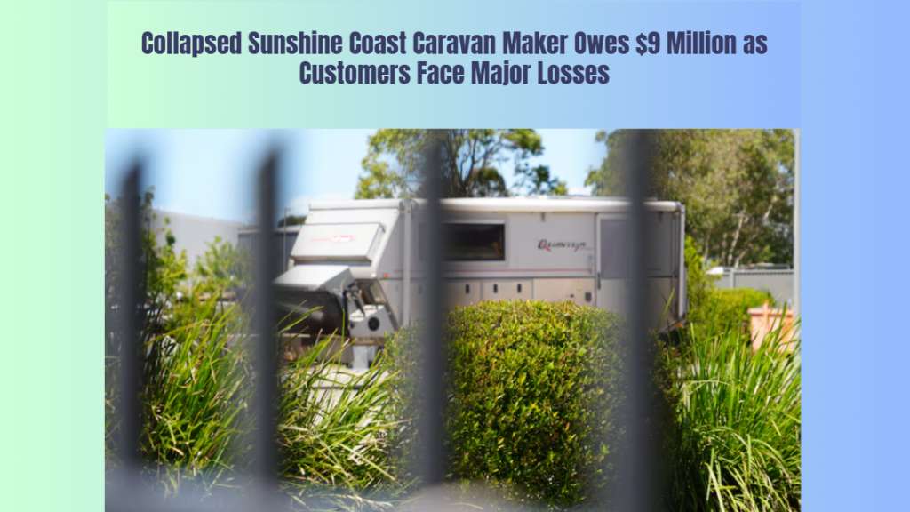
Administrators have revealed Australian Off Road owes about $9 million after the Sunshine Coast caravan manufacturer collapsed, leaving customers, emplo...
A woman has died following a serious three-vehicle collision involving a commercial bus and two cars in Glenburn, in Victoria’s Yarra Ranges, on Thursday, 24 September 2026. Eme...
A woman has died following a serious three-car collision in Leongatha, Victoria, on Wednesday afternoon, 23 September 2026. Emergency services were called to the Strzelecki High...
A Queensland parliamentary committee has completed regional hearings on proposed tougher bail laws, hearing from crime victims, legal experts and commun...