Safety note: Admin approval is an initial review, not a guarantee that every detail is correct. Check important or urgent claims with official sources and report anything inaccurate or unsafe.
Source and credit: Contributor's own report
Cold Southern Surge Brings Chilly Days, Coastal Winds and Showers Across South-East Queensland - Bundaberg, QLD
Smart summary
A burst of cold southern air is bringing lower temperatures, gusty coastal winds and scattered showers to parts of South-East Queensland, with residents urged to prepare for several days of wintry conditions.
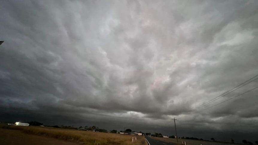
Residents across South-East Queensland are being urged to prepare for a noticeable change in weather as a cold southern surge moves across the region, bringing chilly temperatures, brisk coastal winds and scattered showers over the coming days. The weather system is expected to affect communities throughout the Wide Bay, Burnett and South Burnett regions, with cooler daytime conditions and cold overnight temperatures becoming more widespread.
According to weather forecasts, the cold change is being driven by a strong high-pressure system pushing cool southerly air northward along Queensland's coastline. As the colder air interacts with moisture from the Tasman Sea, coastal communities are expected to experience periods of light rain, increased cloud cover and fresh to strong winds. Inland areas are likely to remain mostly dry but will experience significantly cooler mornings and nights.
Coastal locations including Bundaberg, Hervey Bay and K'gari (Fraser Island) are forecast to receive light showers, with gusty winds making temperatures feel even colder than the actual readings. Some areas may also experience isolated thunderstorms, particularly near the coast, although widespread severe weather is not expected.
Further inland, communities such as Kingaroy, Monto and surrounding South Burnett districts are expected to avoid most of the rainfall but will wake to crisp winter mornings. Overnight temperatures are forecast to fall into the single digits, while daytime temperatures are expected to remain around the high teens to low twenties, creating ideal conditions for frost in some elevated locations.
Meteorologists say the strongest winds will be experienced along exposed coastal areas, where gusts could reach around 35 km/h. The combination of cool temperatures and persistent southerly winds is expected to create uncomfortable wind chill, especially for people working outdoors or participating in recreational activities near the coast. Boaters and beachgoers are also being advised to monitor marine forecasts, as rougher sea conditions may develop while the southerly change moves through.
Authorities are encouraging residents to dress warmly, particularly during the early morning and evening hours when temperatures will be at their lowest. Drivers are also being reminded to exercise caution in areas affected by morning fog or light showers, as visibility may be reduced for short periods. Farmers and rural communities are being advised to monitor livestock and crops that may be sensitive to colder overnight conditions.
The cooler weather is expected to persist through the end of the week before conditions gradually improve as the high-pressure system moves east. While rainfall totals are expected to remain relatively low, the combination of cool air, fresh winds and intermittent showers will provide a distinctly wintry feel across much of South-East Queensland. Forecasters say residents should continue checking local weather updates, as coastal shower activity and wind strength may vary depending on the movement of the weather system.
ExpectedTemperaturesWeatherWindsCoastal
Residents across South-East Queensland are being urged to prepare for a noticeable change in weather as a cold southern surge moves across the region, bringing chilly temperatures, brisk coastal winds and scattered showers over the coming days. The weather system is expected to affect communities throughout the Wide Bay, Burnett and South Burnett regions, with cooler daytime conditions and cold overnight temperatures becoming more widespread.
According to weather forecasts, the cold change is being driven by a strong high-pressure system pushing cool southerly air northward along Queensland's coastline. As the colder air interacts with moisture from the Tasman Sea, coastal communities are expected to experience periods of light rain, increased cloud cover and fresh to strong winds. Inland areas are likely to remain mostly dry but will experience significantly cooler mornings and nights.
Coastal locations including Bundaberg, Hervey Bay and K'gari (Fraser Island) are forecast to receive light showers, with gusty winds making temperatures feel even colder than the actual readings. Some areas may also experience isolated thunderstorms, particularly near the coast, although widespread severe weather is not expected.
Further inland, communities such as Kingaroy, Monto and surrounding South Burnett districts are expected to avoid most of the rainfall but will wake to crisp winter mornings. Overnight temperatures are forecast to fall into the single digits, while daytime temperatures are expected to remain around the high teens to low twenties, creating ideal conditions for frost in some elevated locations.
Meteorologists say the strongest winds will be experienced along exposed coastal areas, where gusts could reach around 35 km/h. The combination of cool temperatures and persistent southerly winds is expected to create uncomfortable wind chill, especially for people working outdoors or participating in recreational activities near the coast. Boaters and beachgoers are also being advised to monitor marine forecasts, as rougher sea conditions may develop while the southerly change moves through.
Authorities are encouraging residents to dress warmly, particularly during the early morning and evening hours when temperatures will be at their lowest. Drivers are also being reminded to exercise caution in areas affected by morning fog or light showers, as visibility may be reduced for short periods. Farmers and rural communities are being advised to monitor livestock and crops that may be sensitive to colder overnight conditions.
The cooler weather is expected to persist through the end of the week before conditions gradually improve as the high-pressure system moves east. While rainfall totals are expected to remain relatively low, the combination of cool air, fresh winds and intermittent showers will provide a distinctly wintry feel across much of South-East Queensland. Forecasters say residents should continue checking local weather updates, as coastal shower activity and wind strength may vary depending on the movement of the weather system.
Queensland's emerging football prospects are coming together for a three-day Brisbane Lions State Academy showcase, giving young players an opportunity...
A Wavell Heights enrolled nurse has been charged with four counts of alleged sexual assault and one count of wilful exposure, with his professional regi...
A 24-year-old Carina Heights man has been charged with 36 offences following an investigation into alleged break-ins, vehicle offences and other propert...
Cairns Regional Council has unanimously voted to seek $400,000 in Queensland Government funding for a program designed to connect local businesses with the region’s growing film...
An automated external defibrillator and memorial plaque have been installed at Ellery Creek Big Hole following the death of disability advocate Ellen Fr...
Queensland firefighters spent several hours monitoring a significant grass fire at Mary Kinross Park in Bargara, near Bundaberg, after the blaze broke out on Wednesday evening....