Safety note: Admin approval is an initial review, not a guarantee that every detail is correct. Check important or urgent claims with official sources and report anything inaccurate or unsafe.
Source and credit: Contributor's own report
Six-Metre Waves Hit Sydney Coast as Powerful Southerly Winds Sweep NSW - Sydney, NSW
Smart summary
Large swells and hazardous surf conditions are affecting Sydney’s coastline as a cold southerly system moves up the NSW coast.
Sydney’s coastline is being hit by powerful southerly winds and large waves today, with wave heights approaching six metres recorded near the city as a strong weather system moves along Australia’s east coast.
A waverider buoy off Sydney’s Northern Beaches recorded a maximum wave height of 5.7 metres early on Wednesday morning. Further north, waves reaching 5.9 metres were recorded near Crowdy Head later in the morning.
The large swell has developed as strong southerly winds move across the Tasman Sea. The weather system is bringing a sharp change in conditions along the NSW coast, with colder temperatures, blustery winds and hazardous surf affecting coastal areas.
A hazardous surf warning is in place for the Sydney Coast and Hunter Coast. The warning means conditions are considered dangerous for activities including swimming, boating and rock fishing. Coastal users are being urged to take extra care while the large swell continues.
The weather change is being driven by a high-pressure system positioned over the Great Australian Bight and a low-pressure system near New Zealand. The resulting pressure pattern is pushing cold air northwards from the Southern Ocean and generating strong southerly winds across the Tasman Sea.
The cold air is also producing a noticeable temperature drop across Sydney. The city's apparent temperature, which takes wind chill into account, was around 5°C at 8am on Wednesday.
Wind gusts have also been strong in other parts of the NSW coast. Gusts reached 100km/h at Gabo Island, 80km/h at Green Cape and 76km/h at Wattamolla early in the morning. The southerly change is continuing to move north, bringing colder and windier conditions to other coastal areas.
Wave conditions are expected to remain significant along the northern half of the NSW coast before easing later in the week. The combination of strong winds and large surf means people visiting beaches and coastal areas should remain particularly cautious.
The weather system is also expected to affect parts of Queensland as it moves north. Showers and cooler southerly winds are forecast to spread along the central and northern NSW coast and into southeast Queensland during Wednesday and Thursday.
Conditions should gradually improve from Thursday into Friday as the high-pressure system moves across southeastern Australia. Winds and waves are expected to ease, while temperatures should recover quickly heading into the weekend.
For Sydney, temperatures are forecast to rise substantially after the cold conditions, with the maximum temperature expected to increase from around 17°C on Wednesday to about 28°C by Saturday.
The sudden change from cold, windy conditions to warmer weekend weather is typical of spring weather patterns along Australia’s east coast.
CoastWindsConditionsSoutherlySydney
Sydney’s coastline is being hit by powerful southerly winds and large waves today, with wave heights approaching six metres recorded near the city as a strong weather system moves along Australia’s east coast.
A waverider buoy off Sydney’s Northern Beaches recorded a maximum wave height of 5.7 metres early on Wednesday morning. Further north, waves reaching 5.9 metres were recorded near Crowdy Head later in the morning.
The large swell has developed as strong southerly winds move across the Tasman Sea. The weather system is bringing a sharp change in conditions along the NSW coast, with colder temperatures, blustery winds and hazardous surf affecting coastal areas.
A hazardous surf warning is in place for the Sydney Coast and Hunter Coast. The warning means conditions are considered dangerous for activities including swimming, boating and rock fishing. Coastal users are being urged to take extra care while the large swell continues.
The weather change is being driven by a high-pressure system positioned over the Great Australian Bight and a low-pressure system near New Zealand. The resulting pressure pattern is pushing cold air northwards from the Southern Ocean and generating strong southerly winds across the Tasman Sea.
The cold air is also producing a noticeable temperature drop across Sydney. The city's apparent temperature, which takes wind chill into account, was around 5°C at 8am on Wednesday.
Wind gusts have also been strong in other parts of the NSW coast. Gusts reached 100km/h at Gabo Island, 80km/h at Green Cape and 76km/h at Wattamolla early in the morning. The southerly change is continuing to move north, bringing colder and windier conditions to other coastal areas.
Wave conditions are expected to remain significant along the northern half of the NSW coast before easing later in the week. The combination of strong winds and large surf means people visiting beaches and coastal areas should remain particularly cautious.
The weather system is also expected to affect parts of Queensland as it moves north. Showers and cooler southerly winds are forecast to spread along the central and northern NSW coast and into southeast Queensland during Wednesday and Thursday.
Conditions should gradually improve from Thursday into Friday as the high-pressure system moves across southeastern Australia. Winds and waves are expected to ease, while temperatures should recover quickly heading into the weekend.
For Sydney, temperatures are forecast to rise substantially after the cold conditions, with the maximum temperature expected to increase from around 17°C on Wednesday to about 28°C by Saturday.
The sudden change from cold, windy conditions to warmer weekend weather is typical of spring weather patterns along Australia’s east coast.
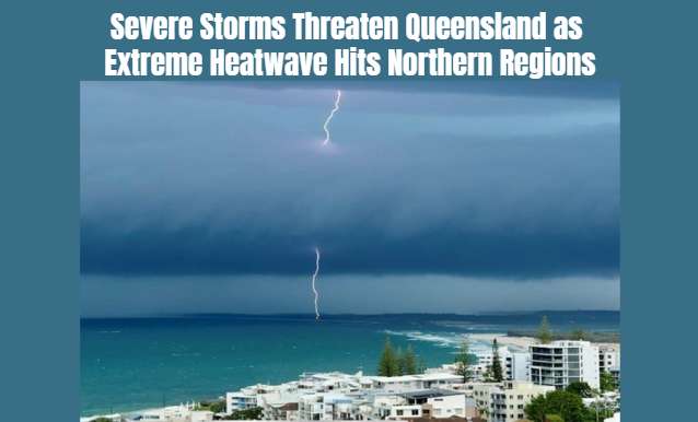
Severe thunderstorms bringing possible large hail, damaging winds and flash flooding are forecast across south-east Queensland, while temperatures in th...
Heavy October rainfall has replenished some farm dams, but Queensland's agriculture minister warns that several drought-declared regions still need sust...
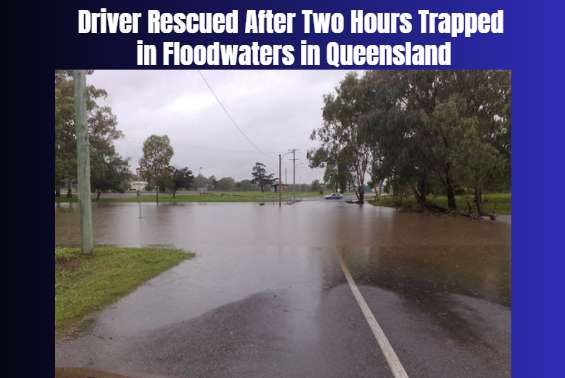
Emergency crews rescued a driver stranded near Mullens Road in Talgai as heavy rain and flash flooding disrupted communities across Queensland’s Souther...
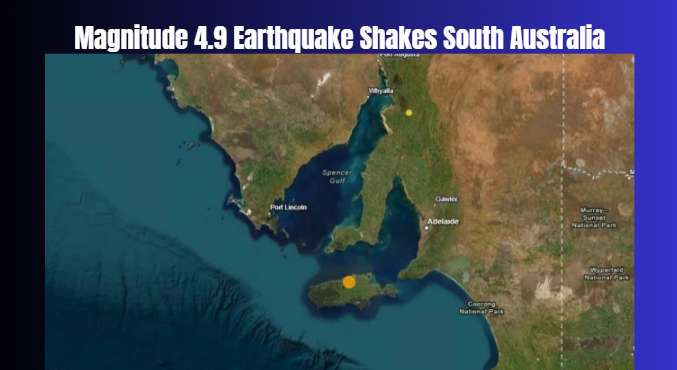
Residents across Adelaide and surrounding areas reported shaking after an earthquake struck offshore, prompting Geoscience Australia to warn that afters...
New South Wales has begun accepting firearms under the national gun buyback scheme, but limited appointment availability has created an early challenge...
Australian property values have fallen for seven consecutive months, with the national median home value dropping approximately $63,400 since March as h...
Education experts support New South Wales' proposal to replace computer-based NAPLAN writing tests with traditional pen-and-paper examinations for stude...
Police are investigating after a one-year-old child died following a house fire in Collie, while several other people inside the property escaped safely.
A psychiatric report presented to South Australia's Supreme Court has raised questions about Tamika Chesser's mental competence in the case involving th...
A freedom of information request has revealed that Gold Coast Council does not hold a copy of the invoice for Mayor Tom Tate's three-day stay at Donald...