Severe Storms Threaten Queensland as Extreme Heatwave Hits Northern Regions
By Chloe · Published 02 Nov 2026 · Updated 02 Nov 2026
Brisbane, QLD · Queensland News
Safety note: Admin approval is an initial review, not a guarantee that every detail is correct. Check important or urgent claims with official sources and report anything inaccurate or unsafe.
Source and credit: Contributor's own report
Severe Storms Threaten Queensland as Extreme Heatwave Hits Northern Regions - Brisbane, QLD
Smart summary
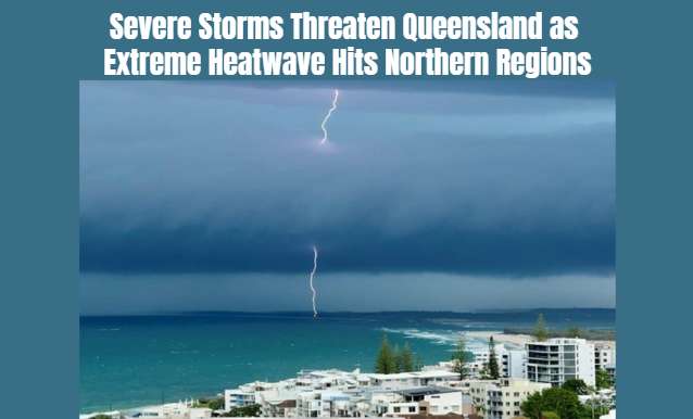
Severe thunderstorms bringing possible large hail, damaging winds and flash flooding are forecast across south-east Queensland, while temperatures in the Gulf Country could reach 40°C.
Queensland is preparing for another round of potentially dangerous weather as meteorologists warn that severe thunderstorms could return to the state's south-east on Tuesday. At the same time, northern parts of the state are experiencing unusually high temperatures, with a severe heatwave forecast across the Gulf Country.
According to the Bureau of Meteorology, Monday is expected to remain mostly fine across several south-east Queensland locations. However, conditions could change significantly on Tuesday, when widespread thunderstorms are forecast to develop across Brisbane, the Sunshine Coast, the Gold Coast and the Darling Downs.
Senior meteorologist Steve Hadley has warned that November is the peak of Australia's thunderstorm season. The latest forecast indicates that some storms could become severe, bringing large hailstones, damaging winds and heavy rainfall.
Authorities are particularly concerned about the possibility of flash flooding. Several areas across Queensland have already experienced substantial rainfall during the previous two weeks. Additional heavy downpours could increase pressure on drainage systems, local waterways and already wet ground.
Recent storms have demonstrated the potential severity of the weather. On Sunday afternoon, hailstones measuring approximately five centimetres were reported near Millmerran, around 200 kilometres west of Brisbane. Hailstones measuring between two and four centimetres were also reported near Blackbutt, north-west of Brisbane.
Although the Darling Downs avoided major damage from a large storm supercell that crossed the region, the latest forecasts suggest that further dangerous weather remains possible.
The Bureau of Meteorology is monitoring atmospheric conditions and expects thunderstorm activity to increase across south-eastern Queensland. Residents are being encouraged to monitor official weather warnings and prepare for rapidly changing conditions.
Meanwhile, Queensland's northern Peninsula and Gulf Country are facing a different weather challenge. A severe heatwave warning has been issued for locations including Kowanyama and Weipa, where temperatures are expected to remain extremely high throughout the week.
Some locations could experience temperatures in the high 30s, with maximum temperatures reaching approximately 40 degrees Celsius on Thursday.
Mount Isa is also expected to experience particularly hot conditions. Its seven-day forecast indicates temperatures around 40 degrees Celsius throughout the week, with overnight minimum temperatures reaching approximately 23 degrees.
Meteorologists say these temperatures are significantly above seasonal averages in some western areas, with conditions potentially reaching eight degrees above normal.
The combination of severe storms in the south-east and extreme heat in northern Queensland highlights the contrasting weather conditions affecting the state.
The heat could increase the risk of dehydration, heat exhaustion and other heat-related illnesses, particularly among older residents, outdoor workers and people without adequate cooling.
Residents are encouraged to drink sufficient water, avoid strenuous outdoor activities during the hottest parts of the day and check on vulnerable neighbours and family members.
People living in storm-prone areas should also secure loose outdoor objects, avoid driving through floodwater and follow emergency advice if severe weather warnings are issued.
The Bureau of Meteorology will continue monitoring conditions as the week progresses. Queensland communities are being urged to remain alert because both severe thunderstorms and extreme heat can create dangerous conditions.
ConditionsQueenslandSevereTemperaturesWeather
Queensland is preparing for another round of potentially dangerous weather as meteorologists warn that severe thunderstorms could return to the state's south-east on Tuesday. At the same time, northern parts of the state are experiencing unusually high temperatures, with a severe heatwave forecast across the Gulf Country.
According to the Bureau of Meteorology, Monday is expected to remain mostly fine across several south-east Queensland locations. However, conditions could change significantly on Tuesday, when widespread thunderstorms are forecast to develop across Brisbane, the Sunshine Coast, the Gold Coast and the Darling Downs.
Senior meteorologist Steve Hadley has warned that November is the peak of Australia's thunderstorm season. The latest forecast indicates that some storms could become severe, bringing large hailstones, damaging winds and heavy rainfall.
Authorities are particularly concerned about the possibility of flash flooding. Several areas across Queensland have already experienced substantial rainfall during the previous two weeks. Additional heavy downpours could increase pressure on drainage systems, local waterways and already wet ground.
Recent storms have demonstrated the potential severity of the weather. On Sunday afternoon, hailstones measuring approximately five centimetres were reported near Millmerran, around 200 kilometres west of Brisbane. Hailstones measuring between two and four centimetres were also reported near Blackbutt, north-west of Brisbane.
Although the Darling Downs avoided major damage from a large storm supercell that crossed the region, the latest forecasts suggest that further dangerous weather remains possible.
The Bureau of Meteorology is monitoring atmospheric conditions and expects thunderstorm activity to increase across south-eastern Queensland. Residents are being encouraged to monitor official weather warnings and prepare for rapidly changing conditions.
Meanwhile, Queensland's northern Peninsula and Gulf Country are facing a different weather challenge. A severe heatwave warning has been issued for locations including Kowanyama and Weipa, where temperatures are expected to remain extremely high throughout the week.
Some locations could experience temperatures in the high 30s, with maximum temperatures reaching approximately 40 degrees Celsius on Thursday.
Mount Isa is also expected to experience particularly hot conditions. Its seven-day forecast indicates temperatures around 40 degrees Celsius throughout the week, with overnight minimum temperatures reaching approximately 23 degrees.
Meteorologists say these temperatures are significantly above seasonal averages in some western areas, with conditions potentially reaching eight degrees above normal.
The combination of severe storms in the south-east and extreme heat in northern Queensland highlights the contrasting weather conditions affecting the state.
The heat could increase the risk of dehydration, heat exhaustion and other heat-related illnesses, particularly among older residents, outdoor workers and people without adequate cooling.
Residents are encouraged to drink sufficient water, avoid strenuous outdoor activities during the hottest parts of the day and check on vulnerable neighbours and family members.
People living in storm-prone areas should also secure loose outdoor objects, avoid driving through floodwater and follow emergency advice if severe weather warnings are issued.
The Bureau of Meteorology will continue monitoring conditions as the week progresses. Queensland communities are being urged to remain alert because both severe thunderstorms and extreme heat can create dangerous conditions.
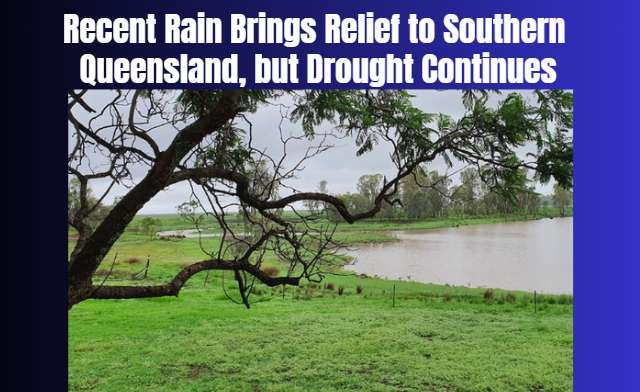
Heavy October rainfall has replenished some farm dams, but Queensland's agriculture minister warns that several drought-declared regions still need sust...
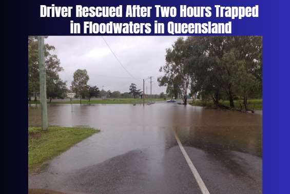
Emergency crews rescued a driver stranded near Mullens Road in Talgai as heavy rain and flash flooding disrupted communities across Queensland’s Souther...
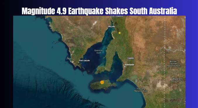
Residents across Adelaide and surrounding areas reported shaking after an earthquake struck offshore, prompting Geoscience Australia to warn that afters...
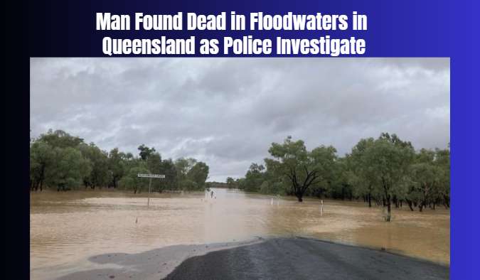
Emergency services found a man dead in floodwaters at Smothering Creek after being called to Boompa Road. Police are investigating the circumstances and...
Eight people have died in separate road crashes across Victoria during the Melbourne Cup long weekend, with four of the fatal incidents involving motorc...
The new laboratory in Bundaberg will allow Indigenous rangers and traditional owner groups to test water locally, strengthening environmental management...
A large crocodile sighting near Rockhampton's proposed Olympic rowing venue has renewed concerns about public safety, wildlife management and the risks...
Eight people have died in separate road crashes across Victoria during the Melbourne Cup long weekend, with four of the fatal incidents involving motorc...
A fisherman escaped unharmed after a large crocodile climbed onto his boat while he was fishing alone on the Mary River, prompting renewed safety warnin...
New South Wales has begun accepting firearms under the national gun buyback scheme, but limited appointment availability has created an early challenge...