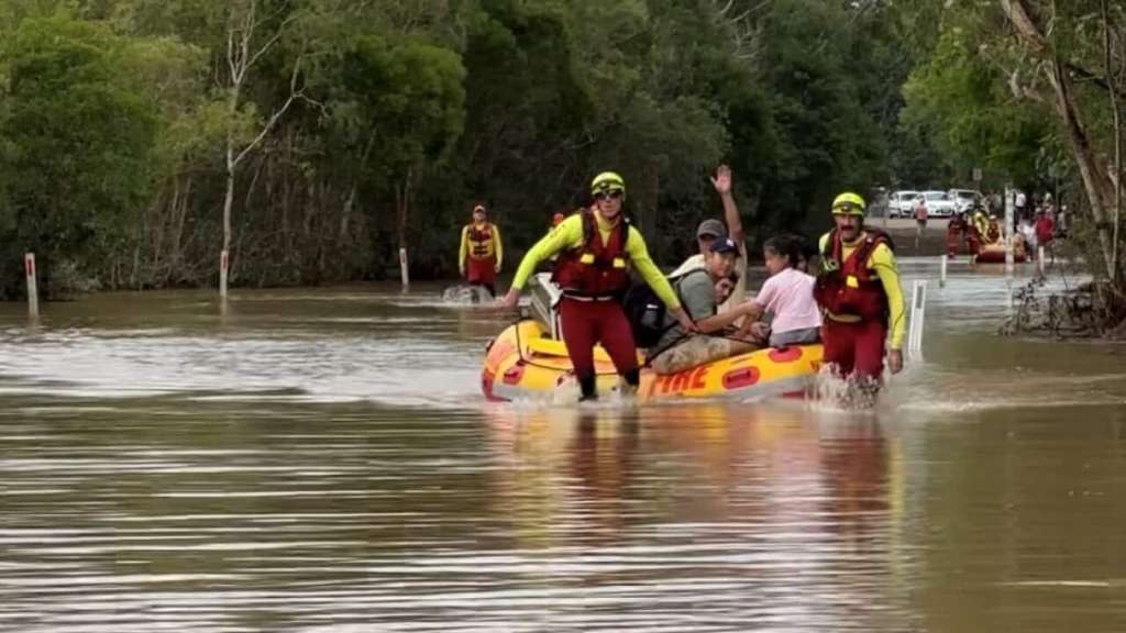
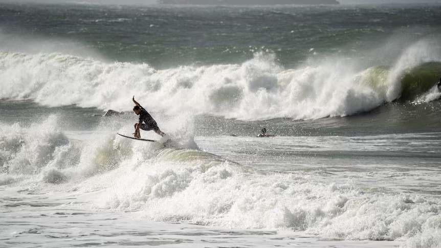
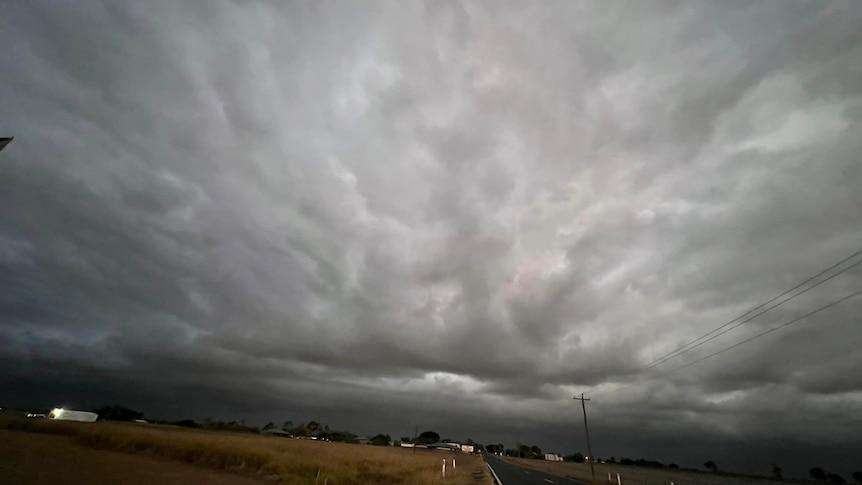
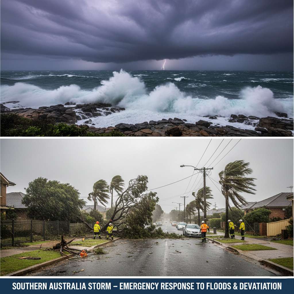
South Australia is currently grappling with a significant bout of wild winter weather, as a powerful low-pressure system moves across the region. The system, which originated in Western Australia, has brought a combination of heavy rainfall, damaging winds, and unusually high tides, creating hazardous conditions for communities across coastal and metropolitan areas. Emergency services and weather authorities have issued multiple warnings as the state faces the brunt of this intense weather event. The Bureau of Meteorology has highlighted the risk of coastal inundation in vulnerable, low-lying areas, particularly as strong winds coincide with high tides and rough seas. Residents along Adelaide’s metropolitan coastline, Kangaroo Island, and other exposed regions are being urged to monitor conditions closely and adhere to the guidance provided by emergency services. The combination of powerful waves and high tides has also raised concerns regarding coastal erosion and hazardous surf conditions. In the Adelaide metropolitan area, heavy rainfall has already resulted in localised flooding on several roads and low-lying streets. These conditions have led to significant traffic disruptions and created dangerous driving environments. Emergency crews have been kept busy responding to numerous incidents, including reports of fallen trees, damaged fences, and structural issues such as roof damage caused by intense wind gusts. The State Emergency Service (SES) has reported responding to dozens of weather-related call-outs since the system arrived, with teams working tirelessly to clear debris and assist residents in securing their properties. Beyond the immediate impact of wind and rain, the storm has caused widespread power outages, affecting thousands of homes and businesses across the state. Utility crews have been deployed to restore electricity; however, the ongoing severe weather conditions may continue to hamper repair efforts in some locations. Meteorologists have noted that wind gusts in some exposed areas, particularly near the coast and elevated terrain, are forecast to approach 100 kilometres per hour. While the system is expected to gradually ease later in the week, forecasters warn that gusty winds, showers, and rough seas may persist for several days. Authorities are strongly advising the public to remain indoors during the peak of the storm, avoid unnecessary travel, and stay well clear of floodwaters, fallen power lines, and coastal hazards. Residents are encouraged to ensure they have emergency kits prepared, keep mobile devices charged, and stay updated through official weather channels. This weather event serves as a stark reminder of the challenges posed by Australia’s winter systems and the critical importance of community preparedness. Further details may be updated as more information becomes available.
South Australia is facing a significant bout of wild winter weather, with heavy rainfall, damaging winds and unusually high tides creating dangerous conditions across coastal and metropolitan regions. Emergency services and weather authorities have issued multiple warnings as a powerful low-pressure system continues to move across southern Australia, bringing widespread disruption and increasing the risk of flooding and property damage. The Bureau of Meteorology has warned that strong winds, combined with high tides and rough seas, could lead to coastal inundation in vulnerable low-lying areas. Communities along Adelaide’s metropolitan coastline, Kangaroo Island and other exposed coastal regions have been advised to monitor conditions closely and follow emergency service advice. Hazardous surf and coastal erosion are also possible as powerful waves batter the shoreline. In Adelaide and surrounding suburbs, periods of heavy rain have already caused localised flooding on roads and low-lying streets. Several routes experienced water over the roadway, creating dangerous driving conditions and traffic disruptions. Emergency crews have responded to numerous incidents involving fallen trees, damaged fences and roofing, while strong wind gusts have brought down branches and caused minor structural damage in some areas. The State Emergency Service (SES) has handled dozens of weather-related call-outs since the system arrived, with crews working to clear debris, assist residents and secure damaged properties. Authorities are urging people to remain indoors during the worst conditions, avoid unnecessary travel and stay away from floodwaters, fallen power lines and coastal hazards. Power outages have also affected thousands of homes and businesses across South Australia as strong winds damaged electricity infrastructure. Utility crews have been deployed to restore services, although ongoing severe weather may hamper repair efforts in some locations. Residents have been encouraged to prepare emergency kits, charge devices and remain updated through official weather channels. Meteorologists say the storm system originated in Western Australia before tracking east across the continent. The weather event has already generated destructive winds and widespread disruption in parts of WA and is now impacting South Australia, Victoria and New South Wales. Wind gusts approaching 100 kilometres per hour have been forecast in some exposed areas, particularly near the coast and elevated terrain. While the severe conditions are expected to gradually ease later in the week, forecasters warn that showers, gusty winds and rough seas may persist for several days. Residents are being encouraged to stay informed through weather updates and heed any emergency warnings issued by authorities. The combination of rain, wind and high tides serves as a reminder of the challenges posed by Australia’s winter weather systems and the importance of preparedness during severe weather events.